Nisqually Reach Aquatic Reserve Adds 5,400 Acres for 90 Years
Washington has expanded the Nisqually Reach Aquatic Reserve by 5,400 acres, bringing its total to 20,100 acres and withdrawing the added state tidelands and wetlands from general leasing for 90 years. The order includes shores around all of McNeil Island and cites protection of Puget Sound salmon and orcas.
The order was signed by Dave Upthegrove, Washington’s Commissioner of Public Lands, at the Nisqually Reach Nature Center on a Wednesday. The exact calendar date is not reported in the account available here. The expansion follows the reserve’s original dedication in 2011 and came after a proposal from DNR Aquatic Marine Reserves manager Jill Prewitt, Upthegrove told The News Tribune.
The ceremony’s setting made the issue tangible: harbor seals were hunting outside the windows as tribal members, state staff and local nature-center employees gathered inside. Still, the central change is administrative, not magical. A boundary and a 90-year leasing restriction can preserve options for habitat protection, but neither one alone guarantees more salmon, more fishing days or a recovery in orca numbers. That distinction matters.
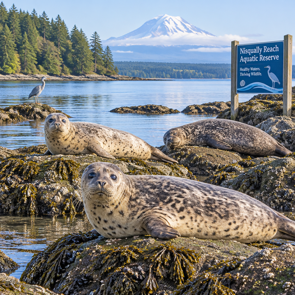
What Is the Nisqually Reach Aquatic Reserve?
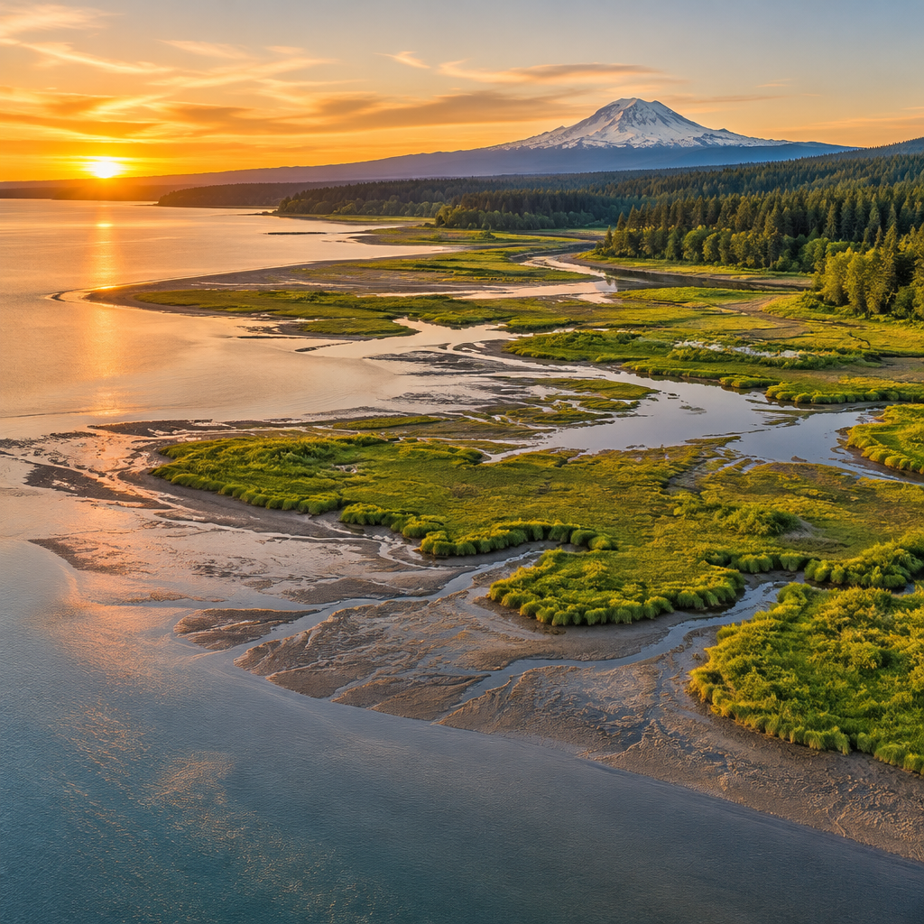
An aquatic reserve is a designated area of state-owned aquatic lands managed for conservation and related public purposes. The Nisqually Reach reserve covers tidelands and wetlands in South Puget Sound, where the Nisqually River meets marine waters. Washington’s Department of Natural Resources oversees state aquatic lands and describes its reserve program on its aquatic reserves information page. The designation is a management tool; it is not a fence around the water.
That point is easy to miss. A reserve does not automatically close an area to every person or activity, nor does it erase every existing legal right. Here, the commissioner’s order is described specifically as withdrawing listed Washington tidelands and wetlands from general leasing and adding them to the reserve for 90 years. The text available does not spell out every permit, use, exception or enforcement detail. Those would require the signed order and its supporting maps.
The boundary change is measurable. Before the order, the reserve covered 14,700 acres; afterward, it covers 20,100. That is a net addition of 5,400 acres, or about 37 percent of the prior area. The newly included territory extends around the full shoreline of McNeil Island, according to the report. This makes the order more than a symbolic statement, although its practical reach depends on what state lands the legal description actually includes.
The reserve also sits within a place with deep tribal and community ties. Nisqually Tribe Chairman James Slape Jr. called the estuary home and described a family history rooted in fishing, diving for geoduck and salmon restoration. He said the Medicine Creek treaty was signed nearby 172 years earlier. The Nisqually Tribe’s official website provides more information about the community and its work. A public decision about the estuary cannot be understood only as a land-use calculation; it also concerns a living relationship between people, place and food.
I read the reserve as a long-term constraint on one category of state land use, not as a complete recovery plan. That is a narrower claim, but a more defensible one. The value of a protected boundary will depend on management, monitoring and cooperation after the cameras leave.
Core Details: What Changed, and What Did Not
The clearest fact is the acreage. The reserve now covers 20,100 acres, up from 14,700, an expansion of 5,400 acres. Upthegrove’s order directs that the described state tidelands and wetlands be removed from general leasing for 90 years from the date of signature. The order names Puget Sound king salmon and Puget Sound orca as reasons for the expansion.
Those are important aims, not automatic results. Protecting aquatic lands from general leases may reduce pressure for some future uses, but the order as reported does not establish that all industrial activity, vessel traffic or fishing is prohibited. Nor does it say that every harmful condition affecting salmon or orcas originates inside the reserve. Rivers carry pollution and sediment; fish move between fresh and salt water; whales travel through a much wider area than this reserve. The boundary can help protect a place. It cannot do the work of an entire watershed or marine policy by itself.
The fishing figures offered at the event give the decision a human measure. David Troutt, the Nisqually Tribe’s natural resources director, recalled fishing 105 days between June and February in 1987. By 2017, he said, the tribe fished only 12 days. He put the current figure at about 30 days a year and described a hope of reaching 50, then 100 days. Those numbers are his account of tribal fishing time, not a claim that this reserve expansion alone will produce a particular increase.
That caution is not pedantry. Fisheries depend on multiple factors, and a restoration effort can take years to show a measurable result. NOAA’s Chinook salmon overview describes the species’ complex life cycle and the pressures that can affect it. NOAA also lists Southern Resident killer whales as endangered. The commissioner’s order refers to Puget Sound salmon and orcas; the reserve’s contribution to their condition will need to be assessed with evidence over time.
There is also a governance detail worth keeping in view. The reserve is an action by the state, while the estuary’s history and use involve the Nisqually Tribe and its treaty relationship. Nothing in the reported order suggests it rewrites treaty rights. Its stated action is to change the leasing status of specified state aquatic lands. Good policy should protect ecological resources while respecting the dignity, livelihoods and rights of people who depend on them. That is the common good in practical terms, not a slogan.
Frankly, the most useful next questions are ordinary ones: What precise parcels are included? What uses remain permissible? How will habitat changes and fish returns be tracked? The ceremony established the decision. The public still needs clear answers about implementation.
Timeline: How the Expansion Happened
- The reserve was established in 2011. The Nisqually Reach Aquatic Reserve began with a boundary of 14,700 acres. The available account does not provide a detailed history of the original designation, so claims about every earlier proposal or management milestone would be guesswork. The state’s aquatic reserve program page is the proper place to check the program’s broader purpose and current information.
- The estuary’s uses and pressures continued to change. Tribal natural resources director David Troutt described a sharp decline in the number of days the tribe fished the area: 105 days in 1987, 12 in 2017 and around 30 at the time of his remarks. Those figures capture a long view from someone who has worked with the tribe since 1987, but they do not isolate one cause. The report does not assign the decline to a single development, regulation or environmental change.
- DNR staff proposed adding acreage. Upthegrove said reserve manager Jill Prewitt brought him the expansion plan. His quip that “she had me at hello” conveyed support, but it does not substitute for the order’s legal reasoning or maps. Those documents matter more than a line delivered at a podium.
- The commissioner signed the order at the nature center. On Wednesday, in front of tribal members, DNR employees, journalists and nature-center staff, Upthegrove signed an order adding the described lands to the reserve. He said the expansion would protect Puget Sound king salmon and orcas for future generations. The order makes the leasing withdrawal effective for 90 years from the signature date; the exact calendar date is not reported here.
- Tribal leaders put the action in historical context. Chairman Slape described the estuary as his home and recalled a failed plan for a large deepwater port near the Nisqually River’s mouth. He contrasted that proposal with the existing Ports of Olympia and Tacoma. His statement that a port would never succeed there was an expression of conviction, not a formal finding in the commissioner’s order.
- The work now shifts to follow-through. Troutt said the tribe hoped to move from roughly 30 fishing days toward 50 and eventually 100. I would treat that as an aspiration, not a forecast. The next measurable steps are likely to be the publication of clear boundary documents, coordination among agencies and tribes, and monitoring that can show whether habitat and fish outcomes improve.
The order’s 90-year span is unusually long by the standards of an ordinary political term. But duration is not the same as permanence. Future officials will inherit the responsibility to carry out the rules, explain them and review the evidence.
Comparison: The Reserve Before and After Expansion
There is no direct commercial rival in the reported facts, and calling another local reserve a “competitor” would create a false comparison. The useful comparison is the reserve before the order and the reserve after it. The figures below are the acreage and terms stated in the account of the signing; no separate lease-by-lease inventory is reported.
| Measure | Before expansion | After expansion |
|---|
| Reserve area | 14,700 acres | 20,100 acres |
| Added area | — | 5,400 acres |
| General leasing status described in the order | Existing reserve boundary | Specified added state tidelands and wetlands withdrawn from general leasing |
| Duration of new order | — | 90 years from signature |
| McNeil Island shoreline | Not included in the new expansion description | Shores around the entirety of the island included |
| Stated conservation purpose | Existing reserve designation | Protection of Puget Sound king salmon and Puget Sound orca |
The table shows a substantial boundary change, but it cannot tell readers how much habitat will improve. Acres are a useful unit for mapping. They are a poor substitute for measures such as eelgrass condition, water quality, salmon survival, prey availability or documented use by wildlife. The reporting does not provide baseline measurements for those indicators, so none should be implied.
Nor does the table show whether a specific lease application was pending, whether any existing lease is affected, or how the order interacts with permits issued by other agencies. Those facts are not reported. The phrase “withdrawn from general leasing” should be read as written, not inflated into a promise that every industrial or commercial use has been outlawed.
The port discussion helps explain why the boundary has political weight. Slape said a large deepwater port had once been proposed near the river mouth and argued that it would not be built. The expansion is a state land decision that makes one future pathway harder: leasing the described aquatic lands through the general leasing process. It does not, by itself, settle every future dispute over shipping, land use or regional infrastructure.
Here’s the kicker: a long restriction can shape investment expectations before any bulldozer appears. That can matter to conservation, but the public deserves precision about which activities are restricted and which are not. The DNR’s posted legal documents, rather than event-day shorthand, will decide those details.
Common Misconceptions and What to Know
Misconception: The expansion closes 5,400 acres to everyone. The reported order withdraws specified state tidelands and wetlands from general leasing. That is not the same as barring all public access, fishing, navigation or research. The account does not list every permitted use or exception, so readers should not assume either a total closure or unrestricted access. The order and its maps are needed for a definitive answer.
Misconception: A reserve guarantees salmon recovery. It does not. Habitat protection can be part of a recovery effort, but salmon depend on conditions across rivers, estuaries and the ocean. NOAA’s material on Chinook salmon is a reminder that the species’ life cycle crosses many environments. The report offers no forecast for fish populations after this decision. A better test is whether future monitoring documents improved habitat and stronger fish returns.
Misconception: The order alone will restore tribal fishing time. Troutt’s comparison—from 105 days in 1987 to 12 in 2017, then about 30 at the time of the event—makes the stakes plain. Yet he described a hoped-for increase, not a guaranteed outcome. Many factors affect when and how long people can fish. Crediting the reserve for every later improvement would be as careless as blaming it for every continuing problem.
Misconception: The expansion is only symbolic. It has a concrete legal element: 5,400 additional acres and a 90-year withdrawal from general leasing for the specified state lands. That is more than a speech. Still, boundaries need administration, rules need enforcement, and ecological outcomes need measurement. Symbolism and practical effect are not opposites; a public commitment can matter, but it must be followed by work.
Misconception: A reserve boundary resolves the port debate. It changes the status of certain aquatic lands under this order; it does not settle every question about ports or regional development. Slape’s remarks expressed the tribe’s history and position on a past proposal. The report gives no project plans, current application or independent feasibility analysis. Treating those remarks as a new formal ruling would overstate what happened.
Misconception: The 90-year term means no future political choices remain. The order sets a long time horizon from its signature, which is meant to reach beyond current officeholders. But administration, oversight and public reporting still matter. Upthegrove joked that future generations might be “slaves to AI robots,” adding that he had no inside information. It was a joke, not a forecast, and not a reason to dismiss the state’s responsibility for the years in between.
Frequently Asked Questions
How many acres were added to the Nisqually Reach Aquatic Reserve?
The order adds 5,400 acres, increasing the reserve from 14,700 to 20,100 acres. The added boundary includes shores around the entirety of McNeil Island, according to the report.
What does the 90-year leasing restriction mean?
The order withdraws the described Washington state tidelands and wetlands from general leasing for 90 years from the date of signature. It should not be read as a blanket ban on every activity in the water. The available account does not provide a full list of allowed uses or exceptions.
Will the expansion increase salmon and orca populations?
The stated goal is to protect Puget Sound king salmon and orcas, but the report provides no population forecast. A reserve may protect habitat from some leasing pressures; it cannot alone control conditions across the wider waters and river systems these animals rely on. Monitoring will be needed to judge results.
How does the change relate to Nisqually tribal fishing?
Tribal natural resources director David Troutt said the tribe fished 105 days in 1987, 12 days in 2017 and about 30 days at the time of the event. He said the tribe hopes to reach 50 and eventually 100 days. Those goals are hopes, not guaranteed effects of this order.
Final Thought
The expansion matters because it makes a specific choice about state aquatic lands: for 90 years, the newly described tidelands and wetlands will not be available through general leasing. That decision gives conservation and future stewardship greater weight in this part of South Puget Sound. It also places a responsibility on DNR to publish clear maps, explain the legal scope and report what happens after the signing ceremony.
The Nisqually leaders’ remarks make clear that the value of the estuary is not measured only in acreage. Slape spoke of home, family and generations of Nisqually life. Troutt described fishing days as a measure of time on the river—a plain, human unit that says more than a glossy promise ever could. Protecting the common good means taking those ties seriously while testing policy against results, not applause.
A protected boundary is a start. It is not a substitute for restoring habitat throughout the watershed, respecting tribal knowledge, or tracking salmon and orca conditions with reliable data. The public should ask whether the stated 90-year protection is being implemented as written and whether ecological indicators improve. Those are fair questions, not opposition to conservation.
Upthegrove’s AI joke got a laugh, but the real test is much less exotic. People still have to maintain the rules, work with the tribes and care for the place. The order has bought time and narrowed one route to leasing these lands. What the region does with that time will decide whether the expansion becomes more than a line on a map.
{
  "@context": "https://schema.org",
  "@type": "FAQPage",
  "mainEntity": [
    {"@type": "Question", "name": "How many acres were added to the Nisqually Reach Aquatic Reserve?", "acceptedAnswer": {"@type": "Answer", "text": "The order adds 5,400 acres, increasing the reserve from 14,700 to 20,100 acres. The added boundary includes shores around the entirety of McNeil Island, according to the report."}},
    {"@type": "Question", "name": "What does the 90-year leasing restriction mean?", "acceptedAnswer": {"@type": "Answer", "text": "The order withdraws the described Washington state tidelands and wetlands from general leasing for 90 years from the date of signature. It is not a blanket ban on every activity in the water. The available account does not provide a full list of allowed uses or exceptions."}},
    {"@type": "Question", "name": "Will the expansion increase salmon and orca populations?", "acceptedAnswer": {"@type": "Answer", "text": "The stated goal is to protect Puget Sound king salmon and orcas, but the report provides no population forecast. A reserve may protect habitat from some leasing pressures, but monitoring will be needed to judge results."}},
    {"@type": "Question", "name": "How does the change relate to Nisqually tribal fishing?", "acceptedAnswer": {"@type": "Answer", "text": "Tribal natural resources director David Troutt said the tribe fished 105 days in 1987, 12 days in 2017 and about 30 days at the time of the event. He said the tribe hopes to reach 50 and eventually 100 days. Those goals are hopes, not guaranteed effects of this order."}}
  ]
}